 |
|
|
| 9632 |
| Tipo: | Documento |
| Id: | 09632 |
| Título: | Desarrollo de las técnicas de predicción de las inundaciones costeras, prevención y reducción de su acción destructiva : Informe técnico. |
| Autor: | Cuba. Instituto de Meteorología; Cuba. Instituto de Planificación Física; Cuba. Defensa Civil; Cuba. Instituto de Oceanología; Cuba. Instituto de Geografía Tropical. |
| Fuente: | La Habana : Cuba. Instituto de Meteorología. Cuba. Instituto de Planificación Física. Cuba. Defensa Civil. Cuba. Instituto de Oceanología. Cuba. Instituto de Geografía Tropical, feb. 1998. 172p. ilus, mapas, tab. |
| Tema: | INUNDACIONES / PREDICCIONES. métodos / MITIGACION PREVIA AL DESASTRE / CUBA / PLANIFICACION EN DESASTRES. métodos / ANALISIS DE RIESGO |
| Tipo: | Documento |
| Id: | 08906 |
| Título: | Monografía : Diseńo y puesta en marcha del programa nacional de prevención, control y extinción de incendios forestales. |
| Autor: | Ferney Pedreros, Didier. |
| Fuente: | s.l : Colombia. Universidad Nacional de Colombia. Facultad de Ciencias Económicas. Carrera de Administración de Empresas, 1996.218p. tab. Tesis presentada en Colombia. Universidad Nacional de Colombia. Facultad de Ciencias Económicas para obtención del grado de Licenciatura en Administración de Empresas. |
| Tema: | INCENDIOS / MITIGACION PREVIA AL DESASTRE / SISTEMAS DE EXTINCION DE INCENDIOS / CONTROL DE RIESGO / ESTRATEGIAS NACIONALES / PLAN NACIONAL DE ACCION |
| Tipo: | Documento |
| Id: | 08613 |
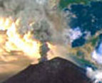
| Título: | Monitoreo volcánico : Instrumentación y métodos de vigilancia. |
| Autor: | Quaas, R; González, Ricardo; Guevara, E; Ramos, E; Cruz - Reyna, S. de la. |
| Fuente: | México. Universidad Nacional Autónoma de México (UNAM); México. Secretaría de Gobernación; México. Centro Nacional de Prevención de Desastres (CENAPRED). Volcán Popocatepétl estudios realizados durante la crisis de 1994-1995. México, D.F : México. Comité Científico Asesor CENAPRED - UNAM, jul. 1995. |
| Resumen: | Dado el gran número de volcanes en México algunos de ellos con un potencial importante de erupción, es fundamental establecer oportunamente sistemas de vigilancia y monitoreo que permitan establecer el estado de su actividad y detectar variaciones que indiquen el inicio de una fase eruptiva mayor. La moderada actividad sísmica y fumarólica del volcán Popocatépetl iniciada en 1993 condujo a iniciar la instalación de estaciones sísmicas de monitoreo. Cuatro estaciones estuvieron en operación y registraron la actividad del volcán durante la pasada crisis iniciada el 21 de diciembre de 1994. A la fecha el sistema está instrumentando con 11 estaciones telemétricas, 8 de ellas con sismómetros y 3 con inclinómetros y un centro de adquisición y procesamiento de datos en CENAPRED. En el presente trabajo se describen en forma detallada el sistema instrumentado en el volcán, las técnicas de observación empleadas y los sistemas para el registro y procesamiento de la información (AU). |
| Tema: | ERUPCIONES VOLCANICAS / EQUIPOS Y SUMINISTROS / ESTACIONES DE MONITOREO / SERVICIOS DE INFORMACION / EVALUACION |
| Tipo: | Documento |
| Id: | 05490 |
| Título: | Mi amigo el bosque : Prevención de incendios forestales. |
| Autor: | Colombia. Sistema Nacional para la Prevención y Atención de Desastres. |
| Fuente: | s.l : Colombia. Sistema Nacional para la Prevención y Atención de Desastres, 1994. 25p. ilus. |
| Tema: | INCENDIOS. prev / MEDIDAS DE SEGURIDAD / MITIGACION PREVIA AL DESASTRE / BOSQUES / ESTRATEGIAS LOCALES / PLANIFICACION EN DESASTRES |
| Tipo: | Documento |
| Id: | 14533 |
| Título: | Tsunami : Las grandes olas. |
| Autor: | Chile. Servicio Hidrográfico y Oceanográfico de la Armada de Chile (SHOA). |
| Fuente: | Valparaíso; Chile. Servicio Hidrográfico y Oceanográfico de la Armada de Chile (SHOA), 2002. 16p. ilus, mapas. |
| Tema: | TSUNAMIS / ALERTA TEMPRANA / PREVENCION Y MITIGACION / DESASTRES NATURALES |
| Tipo: | Documento |
| Id: | 14531 |
| Título: | Como sobrevivir a un maremoto : 11 lecciones del tsunami ocurrido en el sur de Chile el 22 de mayo de 1960. |
| Autor: | Chile. Servicio Hidrográfico y Oceanográfico de la Armada de Chile (SHOA). |
| Fuente: | s.l; Chile. Servicio Hidrográfico y Oceanográfico de la Armada de Chile (SHOA), jul. 2000. 14p. ilus, mapas. |
| Tema: | TSUNAMIS / SOBREVIVIENTES / EVALUACION DE DAŃOS / CHILE / PREVENCION Y MITIGACION / IMPACTO DE LOS DESASTRES |
| Tipo: | Documento |
| Id: | 14526 |
| Título: | Foro-Taller : Manejo integral de incendios forestales. |
| Autor: | Alemania. Deutsche Gesellschaft für Technische Zusammenarbeit (GTZ). |
| Fuente: | Santa Elena, Petén : Alemania. Deutsche Gesellschaft für Technische Zusammenarbeit (GTZ), Red Comunitaria de América Central para la Gestión del Riesgo, Guatemala. Coordinadora Nacional para la Reducción de Desastres (CONRED), ago. 2001. 27p. ilus. Presentado en Foro-Taller : Manejo Integral de Incendios Forestales; Petén, 15-16 ago. 2001. |
| Tema: | CAPACITACION / PREVENCION Y MITIGACION / INCENDIOS / PARTICIPACION COMUNITARIA / ORGANIZACION COMUNITARIA / PLANIFICACION EN DESASTRES / ESTRATEGIAS NACIONALES / INCENDIOS FORESTALES |
| Tipo: | Documento |
| Id: | 14528 |
| Título: | La preparación de las comunidades para la prevención y el control de los incendios forestales. |
| Autor: | Ajú, Juliá. |
| Fuente: | Alemania. Deutsche Gesellschaft für Technische Zusammenarbeit (GTZ). Foro-Taller : Manejo integral de incendios forestales. Santa Elena, Petén : Alemania. Deutsche Gesellschaft für Technische Zusammenarbeit (GTZ), Red Comunitaria de América Central para la Gestión del Riesgo, Guatemala. Coordinadora Nacional para la Reducción de Desastres (CONRED), ago. 2001. Presentado en Foro-Taller : Manejo Integral de Incendios Forestales; Petén, 15-16 ago. 2001. |
| Tema: | PARTICIPACION COMUNITARIA / ORGANIZACION COMUNITARIA / INCENDIOS / PREVENCION Y MITIGACION / PLANIFICACION EN DESASTRES / INCENDIOS FORESTALES / GESTION DEL RIESGO |
| Tipo: | Documento |
| Id: | 14527 |
| Título: | Situación de los incendios forestales en Guatemala. |
| Autor: | López, Miguel Antonio. |
| Fuente: | Alemania. Deutsche Gesellschaft für Technische Zusammenarbeit (GTZ). Foro-Taller : Manejo integral de incendios forestales. Santa Elena, Petén : Alemania. Deutsche Gesellschaft für Technische Zusammenarbeit (GTZ), Red Comunitaria de América Central para la Gestión del Riesgo. Guatemala. Coordinadora Nacional para la Reducción de Desastres (CONRED), ago. 2001. Presentado en Foro-Taller : Manejo Integral de Incendios Forestales; Petén, 15-16 ago. 2001. |
| Tema: | CAPACITACION / PREVENCION Y MITIGACION / INCENDIOS / GUATEMALA / PARTICIPACION COMUNITARIA / ESTRATEGIAS NACIONALES / INCENDIOS FORESTALES |
| Tipo: | Documento |
| Id: | 14525 |
| Título: | Sistema comunitario de alerta temprana para inundaciones : Proyecto MARLAH : Cara Sucia, Ahuachapán, El Salvador. |
| Autor: | Villagrán De León, Juan Carlos. |
| Fuente: | s.l : Proyecto para el Fortalecimiento de Estructuras Locales en la Mitigación de Desastres (FEMID), Alemania. Gobierno de Alemania, dic. 2001.13p. ilus, mapas. |
| Tema: | SISTEMAS DE ALERTA TEMPRANA / PARTICIPACION COMUNITARIA / AMENAZAS/ INUNDACIONES (DESASTRES) / MEDICION DE RIESGO / VULNERABILIDAD/ MONITOREO / PREVENCION Y MITIGACION / EL SALVADOR / GESTION DEL RIESGO |
| Tipo: | Documento |
| Id: | 14523 |
| Título: | Plan básico del ITSU. |
| Autor: | UNESCO. Comisión Oceanográfica Intergubernamental (COI). |
| Fuente: | s.l : UNESCO. Comisión Oceanográfica Intergubernamental (COI); 2 ed, abr. 1999. 34p. ilus, mapas. |
| Tema: | TSUNAMIS / SISTEMAS DE ALERTA TEMPRANA / PREVENCION Y MITIGACION / EVACUACIÓN / PREPARACIÓN / RECOLECCION DE DATOS. instrum / DESASTRES NATURALES |
| Tipo: | Documento |
| Id: | 14517 |
| Título: | La alerta temprana en el contexto de las poblaciones rurales, contrastes entre las erupciones y las inundaciones en Guatemala. |
| Autor: | Villagrán De León, Juan Carlos. |
| Fuente: | Guatemala : Guatemala. Centro de Investigación y Mitigación de Desastres Naturales (CIMDEN), Villa Tek, s.f. 11p. ilus, mapas. |
| Tema: | SISTEMAS DE ALERTA TEMPRANA / ORGANIZACION COMUNITARIA / POBLACION RURAL / GUATEMALA / INUNDACIONES (DESASTRES) / ERUPCIONES VOLCANICAS |
| Tipo: | Documento |
| Id: | 14514 |
| Título: | Se extienden como un reguero de pólvora : Incendios en bosques tropicales en América Latina y el Caribe : Prevención, evaluación y alerta temprana. |
| Autor: | Cochrane, Mark A., ed. |
| Fuente: | México, D.F. : NU. Programa de las Naciones Unidas para el Medio Ambiente (PNUMA). Oficina Regional para América Latina y el Caribe, 2002. 109p. ilus, tab. |
| Tema: | INCENDIOS / IMPACTO AMBIENTAL / MEDIDAS DE SEGURIDAD / FUEGO/PREVENCION Y MITIGACION / DESASTRES PROVOCADOS POR EL HOMBRE / SISTEMAS DE EXTINCION DE INCENDIOS / AMERICA LATINA/REGION DEL CARIBE / INCENDIOS FORESTALES |
| Tipo: | Documento |
| Id: | 14513 |
| Título: | Guías de salud para incedios de vegetación : Documento de orientación. |
| Autor: | Schwela, Dietrich H., ed.; Goldammer, Johann G., ed.; Morawska, Lidia H., ed.; Simpson, Orman, ed. |
| Fuente: | Ginebra : Organización Mundial de la Salud, 1999. 266p. ilus, tab. |
| Tema: | INCENDIOS / MEDIDAS DE SEGURIDAD / IMPACT OS EN LA SALUD / IMPACTO AMBIENTAL / CONTAMINACION DEL AIRE INTERIOR / SISTEMAS DE EXTINCION DE INCENDIOS / MANUALES / INCENDIOS FORESTALES |
| Tipo: | Documento |
| Id: | 14437 |
| Título: | Diagnóstico situacional de las comunidades aledańas al cerro Tapezco : Proyecto Sistema de Alerta Temprana en el cerro Tapezco. |
| Autor: | Costa Rica. Comisión Nacional de Prevención de Riesgos y Atención de Emergencias. |
| Fuente: | San José : Costa Rica. Comisión Nacional de Prevención de Riesgos y Atención de Emergencias, 2000. 61p. ilus, tab. |
| Tipo: | Documento |
| Id: | 14382 |
| Título: | Manual para el diseńo e implementación de un sistema de alerta temprana de inundaciones en cuencas menores. |
| Autor: | OEA. Unidad de Desarrollo Sostenible y Medio Ambiente; Irlanda. Gobierno de Irlanda. |
| Fuente: | Washington, D.C : OEA. Unidad de Desarrollo Sostenible y Medio Ambiente; Irlanda. Gobierno de Irlanda, 2001. 55p. ilus, mapas, tab. |
| Tema: | INUNDACIONES (DESASTRES) / SISTEMAS DE ALERTA TEMPRANA / CUENCAS / PARTICIPACION COMUNITARIA / ALERTA TEMPRANA / PLANIFICACION EN DESASTRES. Org. |
| Tipo: | Documento |
| Id: | 14317 |
| Título: | Mitigando los efectos de El Nińo : Estudio caso sector agrícola, Centroamérica. |
| Autor: | Comité Regional de Recursos Hidráulicos (CRRH); Centro de Coordinación para la Prevención de los Desastres Naturales en América Central (CEPREDENAC). |
| Fuente: | s.l : Comité Regional de Recursos Hidráulicos (CRRH)Centro de Coordinación para la Prevención de los Desastres Naturales en América Central (CEPREDENAC), jul. 2002. 54p. ilus, mapas, tab. |
| Tema: | FENOMENO DE EL NIŃO / PREVENCION Y MITIGACION / AGRICULTURA / AMERICA CENTRAL / ANALISIS DE VULNERABILIDAD / CONTROL DE RIESGO / COOPERACION TECNICA |
| Tipo: | Documento |
| Id: | 14297 |
| Título: | SATs : Sistemas de alerta temprana para emergencias de inundaciones en Centroamérica. |
| Autor: | Villagrán De León, Juan Carlos. |
| Fuente: | Panamá : Centro de Coordinación para la Prevención de los Desastres Naturales en América Central (CEPREDENAC)UNICEF, s.d. 62p. ilus, tab. |
| Tema: | INUNDACIONES (DESASTRES) / ALERTA TEMPRANA / SISTEMAS DE ALERTA TEMPRANA / AMERICA CENTRAL / ALERTA HIDROLOGICA / PROTOCOLOS |
| Tipo: | Documento |
| Id: | 14242 |
| Título: | Guía estatal para la elaboración del plan operativo municipal de protección civil para la temporada de incendios forestales. |
| Autor: | México. Gobierno del Estado de Veracruz - Llave. Dirección General de Protección Civil. |
| Fuente: | Veracruz : México. Gobierno del Estado de Veracruz. Dirección General de Protección Civil, oct. 2000. 25p. ilus. |
| Tema: | INCENDIOS / PLANES DE EMERGENCIA / ORGANIZACION MUNICIPAL / PROTECCION CIVIL / PARTICIPACION COMUNITARIA / PLANIFICACION EN DESASTRES. org. |
| Tipo: | Documento |
| Id: | 14058 |
| Título: | Plan estatal de emergencia para la temporada de lluvias y ciclones tropicales : Análisis de riesgo y vulnerabilidad por inundación de las comunidades ubicadas en las cuencas hidrológicas e inventario de recursos humanos y materiales. |
| Autor: | México. Gobierno del Estado de Veracruz. Dirección General de Protección Civil. |
| Fuente: | Veracruz : México. Gobierno del Estado de Veracruz. Dirección General de Protección Civil, jun. 1999. 206p. ilus, mapas, tab. |
| Tema: | PLANES DE EMERGENCIA / LLUVIAS / CICLON TROPICAL / INUNDACIONES (DESASTRES) / RECURSOS HUMANOS EN DESASTRES / EQUIPOS Y SUMINISTROS EN DESASTRES / ANALISIS DE VULNERABILIDAD / ZONA DE RIESGO / CUENCAS HIDROGRAFICAS / MEDICION DE RIESGO / MÉXICO |
| Tipo: | Documento |
| Id: | 12688 |
| Título: | Guía operacional del sistema de alerta de inundaciones - Cuenca del Río Leán. |
| Autor: | Honduras. Comisión Permanente de Contingencias (COPECO). |
| Fuente: | Tegucigalpa : Honduras. Comisión Permanente de Contingencias (COPECO), 1995. [52]p. ilus, mapas, tab. |
| Tema: | INUNDACIONES (DESASTRES) / PREDICCION DE INUNDACIONES / SISTEMAS DE ALERTA TEMPRANA / CUENCAS HIDROGRAFICAS / CONTROL DE CRECIDAS / ALERTA HIDROLOGICA / HONDURAS |
| Tipo: | Documento |
| Id: | 12319 |
| Título: | Sistema de alertas hidro-meteorológicas en Guatemala en el caso de desastres naturales. |
| Autor: | Guatemala. Instituto Nacional de Sismología, Vulcanología, Meteorología e Hidrología (INSIVUMEH). Unidad de Investigación y Servicios Climáticos. |
| Fuente: | Guatemala : Guatemala. Instituto Nacional de Sismología, Vulcanología, Meteorología e Hidrología (INSIVUMEH). Unidad de Investigación y Servicios Climáticos, sep. 1999. 60p. ilus. |
| Resumen: | El Huracán Mitch, fue uno de los desastres naturales que más dańos causó en el área centroamericana, con grandes dańos materiales y de pérdidas humanas. En este documento se presenta como funcionó el sistema de alertas hidrometeorológicas en Guatemala, pasando por el monitoreo de cada fase y los boletines informativos que se dieron en esa oportunidad. La alerta se dio a nivel departamental y municipal. Luego muestra de forma pormenorizada los dańos causados por el evento Mitch y un informe diario de la secuencia de este huracán. Finalmente se da un registro de las lluvias en las estaciones de la Red Meteorológica-Sinóptica INSIVUMEH. |
| Tema: | HURACANES / MITIGACION PREVIA AL DESASTRE / ALERTA EN DESASTRES / ESTACIONES DE MONITOREO / EVALUACION DE DAŃOS / AGUA DE LLUVIA / GUATEMALA |
| Tipo: | Documento |
| Id: | 12195 |
| Título: | Vivienda segura. |
| Autor: | Argentina. Defensa Civil. Programa de Organización Barrial ante Emergencias ALERTA. |
| Fuente: | Argentina. Defensa Civil. Programa de Organización Barrial ante Emergencias ALERTA. Módulos de capacitación para vecinos voluntarios. s.l : Argentina. Defensa Civil, 1999. |
| Tema: | VIVIENDA / MEDIDAS DE SEGURIDAD / INGENIERIA / FACTORES METEOROLOGICOS / MATERIALES DE CONSTRUCCIÓN |
| Tipo: | Documento |
| Id: | 12194 |
| Título: | Combate contra el fuego. |
| Autor: | Argentina. Defensa Civil. Programa de Organización Barrial ante Emergencias ALERTA. |
| Fuente: | Argentina. Defensa Civil. Programa de Organización Barrial ante Emergencias ALERTA. Módulos de capacitación para vecinos voluntarios. s.l : Argentina. Defensa Civil, 1999. |
| Tema: | INCENDIOS / SISTEMAS DE EXTINCION DE INCENDIOS / PREVENCION DE ACCIDENTES / DESASTRES. prev / EVACUACION / MEDIDAS DE SEGURIDAD |
| Tipo: | Documento |
| Id: | 12190 |
| Título: | Meteorología : Fenómenos naturales. |
| Autor: | Argentina. Defensa Civil. Programa de Organización Barrial ante Emergencias ALERTA. |
| Fuente: | Argentina. Defensa Civil. Programa de Organización Barrial ante Emergencias ALERTA. Módulos de capacitación para vecinos voluntarios. s.l : Argentina. Defensa Civil, 1999. |
| Tema: | METEOROLOGIA / INUNDACIONES (SALUD AMBIENTAL) / MEDIDAS DE SEGURIDAD / TORMENTAS / DESASTRES NATURALES / HURACANES (SALUD AMBIENTAL) |
| Tipo: | Documento |
| Id: | 11676 |
| Título: | Alerta temprana a San José por un debajo de la Península de Nicoya. |
| Autor: | Protti, Marino. |
| Fuente: | San José : NU. Decenio Internacional para la Reducción de los Desastres Naturales (DIRDN), mayo 1999. 8p. ilus. Presentado en: Reunión Hemisférica DIRDN : Por una Reducción en el Impacto de los Desastres Naturales en las Américas ...hacia el siglo XXI; San José, 31 mayo - 5 jun. 1999. |
| Resumen: | Una brecha sísmica madura existe por debajo y frente a la península de Nicoya en el Pacífico norte de Costa Rica. Esta brecha, la brecha sísmica de Nicoya, es un segmento de la Fosa Mesoamericana donde la placa del Coco se subduce bajo la placa del Caribe. Terremotos de gran magnitud han ocurrido en este segmento en 1853, 1900 y 1950. La distribución de réplicas de terremotos ocurridos en la década de los 90s en los segmentos aledańos a esta brecha han permitido afinar su ubicación geográfica y determinar las dimensiones de la misma. Sin deslizamiento sísmico importante desde 1950, con una taza de convergencia de 88 mm/ańo y un área comprendida entre los 5000 y los 10000 km2, la brecha sísmica de Nicoya tiene ya potencial para generar un terremoto con magnitud superior a los 7.5 grados. El Valle Central de Costa Rica, donde se concentra la mayor concentración de su población e infraestructura, se encuentra entre 100 y 250 km de distancia del área potencial de ruptura de la brecha sísmica de Nicoya. estas distancias están dentro del rango de sistemas de alerta temprana para terremotos que han probado ya ser efectivos, haciendo de esta región un excelente sitio para la operación de uno de esos sistemas de alerta (AU). |
| Tema: | ALERTA EN DESASTRES / SISMOS / COSTA RICA / ESTACIONES DE MONITOREO |
| Tipo: | Documento |
| Id: | 05567 |
| Título: | Hazard warnings in meteorology : The importance of remote sensing. |
| Autor: | Foot, J. S. |
| Fuente: | Wadge, Geoff. Natural hazards and remote sensing. s.l : The Royal Society. The Royal Academy of Engineering, 1994. Presentado en: Conference of Natural Hazard Assessment and Mitigation : The Unique Role of Remote Sensing; London, 8-9 Mar. 1994. |
| Resumen: | The prediction on the weather, include extreme events, is now an advanced science whereby observations from a global network are assimilated into complex mathematical models. Forecasters also use the observations to fine-tune the model products and then issue warnings, Satellite based - remote sensing methods, add greatly to our observations database. The most obvious example, and one which saves many hundreds of lives, is the ability to detect and track tropical storms as they develop over the oceans before meeting land. Current remote sensing capabilities are reviewed with examples illustrating their application to different meteorological problems.(AU) |
| Tema: | DESASTRES NATURALES / TELECOMUNICACIONES / COMUNICACIONES POR SATELITE. instrum / FACTORES METEOROLOGICOS / PREDICCIONES / EQUIPOS Y SUMINISTROS / MITIGACION PREVIA AL DESASTRE / PLANIFICACION EN DESASTRES. tend |
| Tipo: | Documento |
| Id: | 00356 |
| Título: | Guidelines for disaster prevention and preparedness in tropical cyclone areas. |
| Autor: | Economic and Social Commission for Asia and the Pacific (ESCAP); World Meteorological Organization (WMO); League of Red Cross Societies and Red Crescent Societies. |
| Fuente: | Geneva : League of Red Cross and Red Crescent Societies, 1977. 125p. ilus, mapas, tab. |
| Tema: | HURACANES / MITIGACION PREVIA AL DESASTRE / INUNDACIONES / REUBICACION POST DESASTRE / REHABILITACION / LEGISLACION / CODIGOS DE EDIFICACION / ALERTA EN DESASTRES / ANALISIS DE RIESGO |
| Tipo: | Documento |
| Id: | 14534 |
| Título: | Tsunami : The great waves. |
| Autor: | Chile. Servicio Hidrográfico y Oceanográfico de la Armada de Chile (SHOA). |
| Fuente: | s.l; Chile. Servicio Hidrográfico y Oceanográfico de la Armada de Chile (SHOA), May 2002. 12p. ilus, mapas. |
| Tema: | TSUNAMIS / ALERTA TEMPRANA / PREVENCION Y MITIGACION / DESASTRES NATURALES |
| Tipo: | Documento |
| Id: | 14524 |
| Título: | Tsunami warning system in the Pacific : Master plan. |
| Autor: | UNESCO. Intergovernmental Oceanographic Commission (IOC). |
| Fuente: | s.l : UNESCO. Intergovernmental Oceanographic Commission (IOC); 2 ed, Apr. 1999. 34p. ilus, mapas. |
| Tema: | TSUNAMIS / SISTEMAS DE ALERTA TEMPRANA / PREVENCION Y MITIGACION / EVACUACIÓN / PREPARACIÓN / RECOLECCION DE DATOS. instrum / DESASTRES NATURALES |
| Tipo: | Documento |
| Id: | 14515 |
| Título: | Spreading like wilfire : Tropical forest fires in Latin America and the Caribbean : Prevention, assessment and early warning. |
| Autor: | Cochrane, Mark A., ed. |
| Fuente: | México, D.F : UN. Environment Programme (UNEP). Regional Office for Latin America and the Caribbean (ROLAC), 2002. 97p. ilus, tab. |
| Tema: | INCENDIOS/IMPACTO AMBIENTAL / MEDIDAS DE SEGURIDAD / FUEGO / PREVENCION Y MITIGACION / DESASTRES PROVOCADOS POR EL HOMBRE / SISTEMAS DE EXTINCION DE INCENDIOS / AMERICA LATINA / REGION DEL CARIBE / INCENDIOS FORESTALES |
| Tipo: | Documento |
| Id: | 14512 |
| Título: | Health guidelines for vegetation fire events : Guideline document. |
| Autor: | Schwela, Dietrich H., ed; Goldammer, Johann G., ed; Morawska, Lidia H., ed; Simpson, Orman, ed. |
| Fuente: | Geneva : World Health Organization, 1999. 219p. ilus, tab. |
| Tema: | INCENDIOS / MEDIDAS DE SEGURIDAD / IMPACTOS EN LA SALUD / IMPACTO AMBIENTAL / CONTAMINACION DEL AIRE INTERIOR / SISTEMAS DE EXTINCION DE INCENDIOS / MANUALES / INCENDIOS FORESTALES |
| Tipo: | Documento |
| Id: | 14454 |
| Título: | Early Warning Systems : Report of the ad hoc Panel. |
| Autor: | UN. Convention to Combat Desertification. |
| Fuente: | UN. International Strategy for Disaster Reduction (ISDR). Secretariat. United Nations documents related to disaster reduction 2000-2002 : Advance copy. Geneva : UN. International Strategy for Disaster Reduction (ISDR). Secretariat, 2003. (ICCD/COP(4)CST/4) |
| Tema: | ALERTA TEMPRANA / SISTEMAS DE ALERTA TEMPRANA / SEQUIAS / DESERTIFICACION / DESASTRES NATURALES / NACIONES UNIDAS / RESOLUCIONES |
| Tipo: | Documento |
| Id: | 14453 |
| Título: | Early Warning System : Report of the ad hoc panel. |
| Autor: | UN. Convention to Combat Desertification. |
| Fuente: | UN. International Strategy for Disaster Reduction (ISDR). Secretariat. United Nations documents related to disaster reduction 2000-2002 : Advance copy. Geneva : UN. International Strategy for Disaster Reduction (ISDR). Secretariat, 2003. (ICCD/CPO(5)/CST/4) |
| Tema: | ALERTA TEMPRANA / SISTEMAS DE ALERTA TEMPRANA / SEQUIAS / DESERTIFICACION / DESASTRES NATURALES / NACIONES UNIDAS / RESOLUCIONES |
| Tipo: | Documento |
| Id: | 14439 |
| Título: | The use of simple fire danger rating systems as a tool for early warning in forestry. |
| Autor: | Buchholz, Georg; Weidemann. |
| Fuente: | International Forest Fire News (IFFN); 23 1-6p., Dec. 2000. ilus, tab. |
| Tema: | INCENDIOS / MONITOREO / MONITOREO DEL AMBIENTE / PREDICCION / PREVENCION Y MITIGACION / MEDIDAS DE SEGURIDAD / METODOS |
| Tipo: | Documento |
| Id: | 12475 |
| Título: | Preventing flood damage through the use of automated flood warning systems and floodproofing of structures. |
| Autor: | Glowacky, Douglas W. |
| Fuente: | Association of State Floodplain Managers. From the mountains to the sea - Developing local capabilities : Proceedings of the Nineteenth Annual Conference of the Association of State Floodplain Managers. Madison : Association of State Floodplain Managers, 1995. Presentado en: Annual Conference of the Association of State Floodplain Managers, 19; Portland, 22-26 May 1995. |
| Resumen: | The Connecticut Automated Local/Statewide Evaluation in Real Time(ALERT) system is an automated early flood warning system. The ALERT system was installed in Connecticut by the Natural Resources Conservation Service (NRCS) in cooperation with DEP in 1985. The system was installed as a direct result of severe flooding that killed 13 persons in June 1982. The purpose of the flood warning system is to aid the DEP and National Weather Service (NWS) in issuing faster flood watches and warnings, and to assist communities in responding more rapidly to flash flooding. The system consists of 48 rainfall gauges, 21 river gauges, 6 weather stations, and 3 coastal tide gauges (1995). These gauges monitor rainfall and river levels statewide, and transmit their data via VHF radio signals to a pair of computer base stations in Hartford, Connecticut. Radio repeaters are used to relay data from the field gages to the centrally located computers. |
| Tema: | INUNDACIONES (SALUD AMBIENTAL) / ALERTA EN DESASTRES / PROGRAMAS DE COMPUTACION / MEDICION DE RIESGO / CONNECTICUT / ESTACIONES DE MONITOREO / AUTOMATIZACION / PROYECTOS PILOTO / PLANIFICACION EN DESASTRES / ESTRATEGIAS LOCALES / MITIGACION PREVIA AL DESASTRE |
| Tipo: | Documento |
| Id: | 12102 |
| Título: | Report on early warning for hydrometeorological hazards including drought. |
| Autor: | O´Neill, Desdond. |
| Fuente: | Geneva : UN. International Decade for Natural Disaster Reduction.IDNDR Early Warning Programme, Oct. 1997. 31p. |
| Tema: | / HIDROMETEOROLOGIA / DESASTRES METEOROLOGICOS / DESASTRES NATURALES / SEQUIAS / ALERTA EN DESASTRES / PREDICCION. Métodos |
| Tipo: | Documento |
| Id: | 12087 |
| Título: | Report on early warning for technological hazards. |
| Autor: | Krejsa, Peter. |
| Fuente: | Geneva : UN. International Decade for Natural Disaster Reduction. IDNDR Early Warning Programme, Oct. 1997. 32p. |
| Tema: | / PLANIFICACION EN DESASTRES. org / ALERTA EN DESASTRES / ACCIDENTES QUIMICOS / MITIGACION PREVIA AL DESASTRE. org |
| Tipo: | Documento |
| Id: | 12086 |
| Título: | Report on early warning for fire and other environmental hazards. |
| Autor: | Goldammer, Johann G. |
| Fuente: | Geneva : UN. International Decade for Natural Disaster Reduction. IDNDR Early Warning Programme, Oct. 1997. 35p. |
| Tema: | / INCENDIOS / MITIGACION PREVIA AL DESASTRE / CONTAMINACION AMBIENTAL / ALERTA EN DESASTRES / EFECTOS DE DESASTRES EN LA SALUD / IMPACTOS EN LA SALUD / ECOSISTEMA |
| Tipo: | Documento |
| Id: | 12085 |
| Título: | Report on early warning capabilities for geological hazards. |
| Autor: | Hamilton, Robert. |
| Fuente: | Geneva : UN. International Decade for Natural Disaster Reduction (IDNDR), Oct. 1997. 36p. |
| Tema: | DESASTRES GEOLOGICOS / PREDICCION. métodos / TERREMOTOS (SALUD AMBIENTAL) / ERUPCIONES VOLCANICAS / DESLIZAMIENTOS DE TIERRA / ALERTA EN DESASTRES |